Our journey takes us to one of the southern provinces of Iran. We plan to visit the spectacular city of Shushtar in Khuzestan Province to see the Shushtar Historical Hydraulic System. This historic complex is among the world’s most unique engineering structures, dating back to the Sassanid era, and is listed as a UNESCO World Heritage site.
If you’re interested in seeing one of the most important engineering structures of the ancient world, join us on this historical journey of Parsi Tours, Iran travel agency, to Shushtar and the exploration of its water structures.
Introduction to the Shushtar Historical Hydraulic System
Described as the largest industrial complex before the Industrial Revolution by Madame Dieulafoy, the astonishing and marvelous structures in Shushtar are something to behold. It wouldn’t be an exaggeration to consider the Shushtar Historical Hydraulic System as one of the wonders of Iran and the ancient Persian culture. The grandeur and marvel of this complex highlight the ingenuity of its builders.
The creators of Shushtar’s water structures had great expertise and technical knowledge in hydraulic engineering. They managed and controlled water for optimal and principled use of water resources. By constructing multiple water structures, diverting and transferring water from the Karun River, they ingeniously utilized the water for drinking, irrigating agricultural lands, and industry.

The Age of the Shushtar Historical Hydraulic System
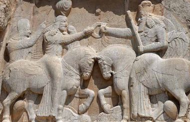
Though it’s likely that the foundation of Shushtar’s water structures was laid during the Achaemenid era, their amazing complexity is attributed to the Sassanid period, associated with kings such as Ardeshir I and Shapur. However, this complex was further developed and expanded over time, including during the Qajar period, as evidenced by documents and records.

The Function of Shushtar Historical Hydraulic System
Each of Shushtar’s water structures has a unique function and purpose, forming an interconnected system. The structures, made of materials like stone, brick, and Sarooj mortar, were once the driving force behind thriving industries and agriculture, playing a significant role in transportation, communication, and trade.
The water structures evenly distributed water throughout the city and prevented the Karun River from flooding. They also created a cool atmosphere, with water channeled to people’s homes through underground structures called Shavadans. Additionally, they irrigated agricultural lands and powered mill wheels for wheat grinding.

Where are the Shushtar Historical Hydraulic System?
The Shushtar Historical Hydraulic System are a remarkable and extraordinary tourist attraction in Iran, Khuzestan Province and among the most important and valuable sights in Shushtar. This industrial-economic complex is situated near the historical fabric of Shushtar and is easily accessible for visitors.

How to Access Shushtar Historical Hydraulic System
To visit Shushtar’s structures, you need to travel to Khuzestan and then head to Shushtar. If coming from Tehran, you can take the Khorramabad-Andimeshk highway towards Shushtar, which takes about 9 hours. Upon entering the city, signposts will guide you to this astonishing attraction. Also, locals can direct you to the water structures.

Different Parts of Shushtar Historical Hydraulic System
The water structure complex of Shushtar includes various components like bridges, dams, mills, waterfalls, canals, Sikas (resting and recreational places), and huge water tunnels. Over time, many parts of the water structures have been destroyed by floods and other factors. However, some remaining parts, known as the Historic Hydraulic System of Shushtar, are registered as a UNESCO World Heritage Site under number 1315. The fifth of Tir month (annually) marks the registration anniversary of Shushtar Historical Hydraulic System, recognized in 2009 as Iran’s tenth world heritage site. Let’s get to know more about the registered parts of Shushtar’s water structures.

Measuring Dam (Band-e Mizan)
The Measuring Dam, also known as Band-e Qeysar, Shapuri, Dolaat-Shah, Taraz, Khaqaan, and Mohammad Ali Shah, splits the Karun River into two branches, Shoteit and Gargar. The dam is named for its role in balancing the water flow between the two rivers, Gargar and Shoteit. Constructed in a circular shape with cut stone and Sarooj at the beginning of the Gargar river, it ends with a European-style tower. The dam has several openings, the most important of which regulates the water distribution between the two branches.
European-Style Tower
The European-style tower is an octagonal structure overlooking the Measuring Dam, standing on a four-meter base. Currently, seven meters of its height remain, adorned with cut stones. There are various theories about the time of construction and the purpose of this tower. Some believe it was a lookout for the Roman Caesar or Sassanian Shapur and a supervisory spot for worker activities. Others think it was used to monitor the river’s flow.
The European-style tower can be seen at 17 Shahrivar Square in Shushtar, at the end of Boulevard Street.
Hand-Dug Gargar River
The Gargar river, flowing north of Shushtar, is a tributary of the Karun River, separated by the Measuring Dam. This artificially hand-dug river was created by the order of Ardeshir, the Sassanian king. The riverbed was paved with stones connected by metal ties to prevent deepening.
The river flows through the city, supplying water to canals and tunnels before joining the Shoteit branch at Band-e Ghir, merging with the Dez River along with Shoteit.

Gargar Bridge Dam
Located downstream of the Measuring Dam and above the mills, the Gargar Bridge Dam, along with three diversion tunnels named Shah, Seh Kureh, and Beliti, play a crucial role. The bridge dam, built on a rock, maintains a specific water level, with tunnels carved inside the rock to supply water to turn the mill wheels. Today, with the mills no longer functioning, water cascades from the tunnel openings as waterfalls.
Complex of Waterfalls and Water Mills
The area of waterfalls and water mills in Shushtar includes a series of tunnels, secondary canals, water mills, and a dam. The complex functions by raising the Gargar river level using the dam, directing water into the three tunnels, dividing it into multiple channels, and after passing through the mills, cascading into pools as picturesque waterfalls. Many of Shushtar’s mills have been destroyed or are no longer in operation, with only the Reza Golab mill still functioning.
The waterfalls and water mills of Shushtar can be seen south of the Gargar Bridge Dam on Shariati Street.
Band-e Berj-e Ayar and the Sabian Temple
Located downstream of the waterfall area on the Gargar River, the Band-e Berj-e Ayar was built inside a garden and supplied by the Beliti tunnel. To the east of this dam are the remains of canals and small rooms. During the Safavid and Qajar eras, this area was used as a Sabian temple.
The dam is near the Imam Ali shrine at the Butcher’s Bridge, opposite the Dekan-e Shams and Dekan-e Sheikh neighborhoods.

Band-e Mahi Bazan or Band-e Khoda Afarin
The Band-e Mahi Bazan or Band-e Khoda Afarin is located between the Gargar and Daryoun rivers in the Mahi Bazan area, which is the ancient city of Dastova. This dam is made of a single stretch of stone and has three walls in the middle, forming water channels.
Salsal Castle
Salsal Castle or the Old Fortress of Shushtar is the oldest part of the water structures, dating back to the Achaemenid era. Besides its defensive role, the castle was used to control the Daryoun canal water. Salsal once included sections like a basement, barracks, tower, bell tower, fortifications, and moat, but today, only a few underground rooms and the Daryoun tunnels remain.
Daryoun Canal
The Daryoun Canal or Daryoun Channel, separating from the Shoteit River, was used for irrigation, drinking water supply, and access to Salsal Castle. After emerging from the stony bed of the castle and traveling southward, passing west of Shushtar, it divides into two branches at the Lashkar Bridge Dam. The canal’s construction is attributed to the Achaemenid era, specifically Darius.
Shadervan Bridge Dam
The Shadervan is a famous bridge mentioned in the Shahnameh, built by a soldier named Branoush from Shapur’s Sassanian army after defeating the Romans. Made of brick, stone, and Sarooj, it is located on the Shoteit branch. Remains of several mills are also seen beside this bridge.
The Shadervan Bridge Dam is close to Azadegan Bridge, about 300 meters south of the Measuring Dam, in the northwest of Shushtar.

Band-e Khak
Another dam in the Shushtar water structures complex is Band-e Khak, located outside the western city wall on the Daryoun canal, 500 meters above the Lashkar Bridge Dam. Raising the water level by several meters, the dam channeled water through multiple canals towards the gardens. Likely built during the Sassanian period, it was restored in the Qajar era.
Band-e Lashkar Bridge
After the Mizan Dam, the Band-e Lashkar Bridge is the best-preserved water structure in this complex. Like other structures, it is made of bricks, stones, and sarooj (a traditional mortar). This bridge played a significant role in connecting Shushtar to the southern villages. It linked Shushtar with the city of Askar Makram and was considered one of the important gateways of Shushtar. On the south side of the Band-e Lashkar Bridge, there are remains of three mills, and at the end of the north side, there is a Chahartaq (a type of ancient Persian architectural element) on a rock.
You can see the Band-e Lashkar Bridge outside the Lashkar gate of Shushtar, near the tomb of Imamzadeh Abdullah.
Band-e Sharabdar Bridge
The Band-e Sharabdar Bridge is located in the south of Shushtar, on the Daryun canal, and is made of stone and sarooj. This bridge served as a communication route from the military fortress of Khorram to the north of the Daryun canal. It is believed to date back to the Parthian era.

Other Parts of Shushtar Historical Hydraulic System
Stairs: In the south of the mills and waterfalls area, there is a handmade stone staircase with more than 200 steps. It connects the area of the waterfalls to the residential areas overlooking the complex. Along this staircase, there are rooms for the guards of the water structures.
Sika: At the end of the western side of the waterfalls area, there is a Sika, which is accessible through several hand-carved steps.
Band-e Dokhtar: About three kilometers north of Shushtar, where the generous Karun River enters the plains from the mountains, the riverbed narrows to its minimum width. The Band-e Dokhtar was built in this location during the Sassanid era. It was named due to its proximity to the Dokhtar Fortress.
Band-e Dara: This dam was built in the Miyanab area, on the Gargar River.
Shah Ali Bridge: Located on the Daryun canal in the south of Shushtar and to the west of Imamzadeh Abdullah.
Where to Stay When Visiting Shushtar’s Water Structures?
If you decide to stay in the historical city of Shushtar, there are several accommodation options where you can spend the night and enjoy viewing Shushtar Historical Hydraulic System at night. Below are some of these places:
Traditional Hotel Khaneh Tabib: Imam Crossroads – Cobblestone Alley
Traditional Hotel Sarabi Shushtar: Abdollah Banu Street, behind Abdollah Banu Tomb
Hotel Gargar: Boulevard of Islamic Azad University – Inside the University Campus
Traditional Accommodation Afzal: Imam Crossroads – Cobblestone Alley – Afzal Alley